We all know how important it is to have a reliable LiDAR system. But what about a multi-sensor system? Is it just as important? The answer is yes.
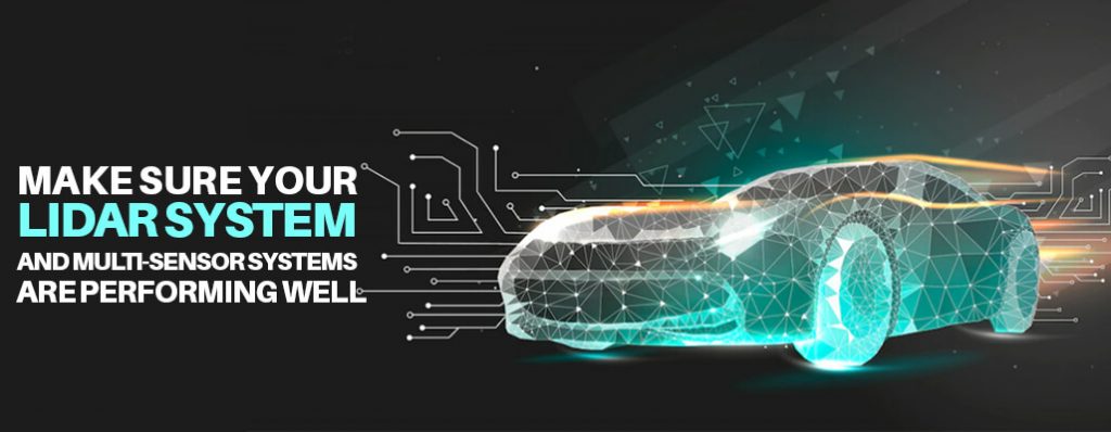
A multi-sensor system is just as important as a 3D LiDAR system. In fact, it is even more important. A multi-sensor system is a combination of LiDAR and other sensors, such as cameras and radar. This combination of sensors makes it possible to get a more accurate picture of the environment.
3D LiDAR alone can only provide a limited view of the world. It can only see what is in front of it. But when you add other sensors to the mix, you can get a much more complete picture of your surroundings. For example, a camera can see things that are behind objects, and radar can see things that are moving. This combination of sensors makes it possible to get a more accurate picture of the environment.
Is LiDAR system meeting industry expectations?
LiDAR system has been shown to be an accurate and reliable technology for measuring distance and detecting objects.
It has been used extensively in a variety of industries, including surveying, mapping, navigation, and law enforcement. Overall, 3D LIDAR has met or exceeded the expectations of the industries that have adopted it.
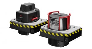
Always Use quality LiDAR sensors
When it comes to collecting high-quality data, LiDAR sensors are essential. These sensors use laser light to detect and map objects, making them ideal for applications like mapping the contours of the earth or measuring vegetation height. LiDAR data is also very accurate, making it perfect for precision applications.
There are many different types of LiDAR sensors on the market, so it is important to choose one that is best suited for your specific needs. Do some research to find a sensor that will give you the quality data you need.
Use multi-sensor systems to achieve maximum data efficiency
Multi-sensor systems can provide more accurate and reliable data than single sensor systems. By using multiple sensors to collect data, multi-sensor systems can reduce the overall error and improve data efficiency. Multi-sensor systems are often used in mission-critical applications where reliability and accuracy are essential.
Use data fusion and image correlation software to improve accuracy and detection
Data fusion and image correlation software can be used to improve accuracy and detection. By combining data from multiple sources, fusion software can provide a more complete picture of an object or scene.
This can be especially helpful in cases where one data source may be obscured or incomplete. Image correlation software can be used to improve detection by looking for patterns in images.
This can be helpful in cases where an object may be camouflaged or otherwise difficult to see.
Choose sensors with 0.1 degree point spread function
When choosing sensors for your application, it is important to consider the sensor’s point spread function (PSF). The PSF is a measure of the sensor’s ability to resolve two objects that are close together.
A 3D LiDAR sensor with a PSF of 0.1 degree will be able to resolve two objects that are 0.1 degree apart. This is important to consider when choosing sensors for applications where high precision is required.
Conclusion
In summary, today’s unified, integrated and AI-enabled sensing and control platforms are enabling new levels of accuracy in autonomous machines.
These systems enable operators to troubleshoot and improve machine performance, detect worker safety threats, reduce maintenance, and optimize performance, whether driving on roadways, working indoors, or using equipment in warehouses.
FAQ
How accurate are lidars?
LiDAR system are generally very accurate, with measurements typically being within a few centimeters. However, factors such as the type of terrain being mapped, the density of objects, and atmospheric conditions can affect the accuracy of lidar data.
What are LiDAR system used for?
3D LIDAR are used for a variety of applications, including mapping and surveying, navigation, obstacle detection and avoidance, and atmospheric research. Lidar systems emit laser pulses and measure the time it takes for the pulses to bounce back off of objects in the environment. This information can be used to create high-resolution 3D maps of an area. Lidar can also be used to detect and avoid obstacles, and to study atmospheric conditions.
Do multiple lidars interfere with each other?
If two or more LiDAR are operated in close proximity to each other, there is potential for the lidars to interfere with each other. This can happen if the lidars are not properly calibrated, or if they are operating on different frequencies. If the lidars are interfering with each other, it can cause inaccurate readings and data.
What are the advantages of LiDAR technology?
The advantages of LiDAR system technology are its high precision, its ability to penetrate fog and clouds, and its relatively low cost. LiDAR can be used to create highly accurate three-dimensional (3D) maps of an area.
Because LiDAR data can be collected very quickly, it can be used to create up-to-date maps of constantly changing environments, such as urban areas. LiDAR system data can also be used to create virtual 3D models of an area.
These models can be used for a variety of purposes, such as planning construction projects or studying the effects of proposed changes to the environment.
Why does Tesla not use LiDAR?
Tesla does not use LiDAR for a variety of reasons. First and foremost, Tesla believes that LiDAR is an expensive and unnecessary technology. Additionally, Tesla is confident in its ability to create highly-accurate maps using its own data and sensors.
Finally, Tesla believes that LiDAR system could potentially blind its autonomous vehicles, making them less safe on the road.
Why does Elon not like LiDAR?
Elon Musk has been vocal about his dislike of LiDAR technology, calling it “unnecessary” and “expensive.” Musk believes that Tesla’s autonomous driving technology, which relies on cameras and sensors, is a more effective and affordable solution.
While LiDAR does have its benefits, Musk believes that the technology is not worth the cost for Tesla.
Who has the best lidar technology?
There are many different types of lidar technology available on the market, each with its own advantages and disadvantages. It can be difficult to determine which type of lidar is best for your specific needs.
Here, we will compare the different types of lidar technology to help you make an informed decision. Types of Lidar Technology There are three main types of lidar technology: airborne, terrestrial, and mobile. Airborne lidar is typically used for large-scale mapping projects, such as mapping an entire city.
This type of lidar can cover a large area quickly and is ideal for projects where detailed data is needed.
Does lidar have a future?
Lidar systems have been used for a variety of purposes over the years, including navigation, surveying, and mapping. In recent years, however, the technology has seen a surge in popularity due to its potential applications in autonomous vehicles. Lidar systems are now being developed for use in self-driving cars, and many believe that the technology will play a vital role in the future of transportation.
Who owns lidar technology?
Lidar technology is owned by a variety of companies, including Velodyne, LeddarTech, and Ouster. These companies produce lidar products for a variety of applications, including self-driving vehicles, robotics, and mapping. Each company has its own unique take on lidar technology, which gives them a competitive edge in the market.
How does a LiDAR system work?
A LiDAR system is an active remote sensing technology that uses laser light to detect and measure surface features on the earth. LiDAR stands for Light Detection and Ranging. The system works by sending out a laser pulse and measuring the time it takes for the pulse to bounce back off the target.
The distance to the target can be calculated from the travel time of the pulse. LiDAR can be used to measure the shape of the earth’s surface, as well as to detect features such as buildings, trees, and other objects.
What are the 4 parts to the LiDAR system?
A LiDAR system is typically composed of four main parts: a laser, a scanner, a GPS receiver, and a computer. The laser is used to emit short pulses of light, which bounce off of objects and are then captured by the scanner.
The GPS receiver is used to track the location of the LiDAR system, while the computer is used to process the data and create a 3D map of the area.
What are the top 5 uses of LiDAR?
1. LiDAR can be used to create detailed maps of landscapes.
2. LiDAR can be used to study plant growth and monitor agricultural crops.
3. LiDAR can be used to assess environmental impact and monitor land use.
4. LiDAR can be used to study animal behavior and movements.
5. LiDAR can be used to improve navigation and safety in transportation.