We are in the middle of an era when Lidar technology has transformed how we map and survey the world. Lidar Maps UK has been used in various applications in the UK, from urban planning to infrastructure development to disaster recovery.
In this blog post, we will take a closer look at the benefits of Lidar Maps UK and how they are being used to unlock valuable insights and improve decision-making in various fields.
Many industries benefit from lidar UK maps, from understanding the topography to identifying potential hazards. Our discussion will also include the evolution of lidar mapping technology, which enables even more precise and detailed mapping.
Let’s look at how UK lidar maps are helping to shape our world as we explore the exciting world of lidar maps.
Benefits of Lidar Maps UK
Urban Planning and Infrastructure Development:
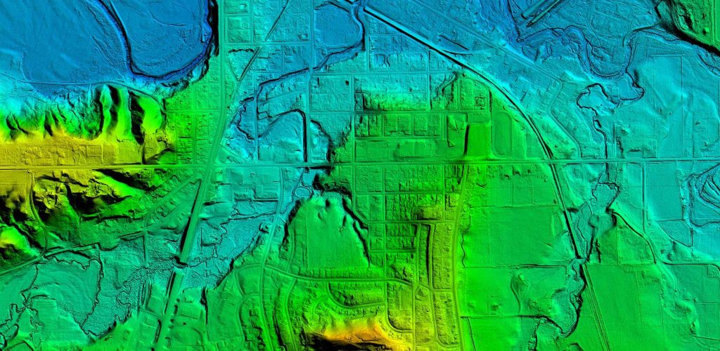
A lidar map is crucial for developing an urban plan and infrastructure because it provides detailed information about the structure and topography of an area. These allow identifying potential hazards, such as flooding and landslides, and planning for new developments, such as roads and buildings.
Environmental Conservation:
Lidar Maps UK enables the creation of detailed 3D models of vegetation in an area, which can be used to monitor ecosystem changes and conserve wildlife.
A map can also be used to locate areas that require reforestation or to identify endangered species.
Disaster Management:
A lidar map can assess damage after a disaster and plan recovery and reconstruction. It is possible to obtain valuable information from lidar UK maps before, during, and after a natural disaster.
They can identify landslides and flood hazards and plan evacuation routes.
Understanding Topography:
Lidar maps UK can provide detailed information about the elevation and contours of an area, which is important for understanding the topography of an area.
In addition to identifying potential hazards, such as flooding and landslides, they can plan for new developments.
Identifying potential hazards:
Lidar can identify hazards like sinkholes and other subsidence issues and other potential hazards like landslides, rock fall, and more.
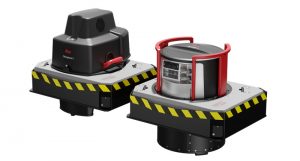
The technology behind Lidar Mapping
Lidar systems emit laser pulses that bounce off the earth’s surface and return to the sensor. By measuring the time it takes for the laser pulse to travel to the object and back, the lidar system can calculate the distance to the object.
This process is repeated many times per second, allowing lidar systems to create highly detailed 3D maps of an area.
Over the years, lidar technology has evolved to provide even more detailed and accurate data. For instance, the use of multi-beam lidar systems, which emit multiple laser beams at once, has greatly increased the speed and accuracy of lidar mapping UK.
Additionally, smaller, more lightweight lidar systems, such as those used in drones, have made it possible to map previously inaccessible areas.
Once the lidar data is collected, it is processed and analyzed to create a detailed 3D map of the area.
It can include creating digital elevation models, identifying features such as buildings, vegetation, and bodies of water, and identifying potential hazards.
What are the benefits of UK Lidar maps?
Lidar Maps UK provides detailed information about an area’s topography and structure, which is crucial for urban planning and infrastructure development.
They can also be used for environmental conservation, disaster management, understanding topography, and identifying potential hazards.
How is Lidar data collected?
Lidar systems emit laser pulses that bounce off the earth’s surface and return to the sensor. By measuring the time it takes for the laser pulse to travel to the object and back, the lidar system can calculate the distance to the object.
This process is repeated many times per second, allowing lidar systems to create highly detailed 3D maps of an area.
How is Lidar data processed and analyzed?
Once the lidar data is collected, it is processed and analyzed to create a detailed 3D map of the area.
It can include creating digital elevation models, identifying features such as buildings, vegetation, and bodies of water, and identifying potential hazards.
What are the applications of Lidar maps UK?
Lidar Maps UK can be used in many applications, such as urban planning, infrastructure development, environmental conservation, disaster management, and more.
They can also be used to understand the topography and identify potential hazards.
How has Lidar technology evolved?
Over the years, lidar technology has evolved to provide even more detailed and accurate data. Lidar mapping has been greatly improved by multi-beam lidar systems that emit multiple laser beams simultaneously.
Additionally, smaller, more lightweight lidar systems, such as those used in drones, have made it possible to map previously inaccessible areas.
In conclusion, UK lidar maps are a powerful tool that can provide valuable insights and improve decision-making in various fields, from urban planning and infrastructure development to environmental conservation and disaster management.
The technology behind lidar mapping continues to evolve, providing more detailed and accurate data. We hope this overview gives you a better understanding of the benefits of Lidar Maps UK and how they can be used in your respective field.