Lidar sensors are a type of sensor that uses lasers to measure distance. They are often used in autonomous vehicles to help the vehicle navigate its surroundings. Lidar sensors can also be used to measure the speed of objects and to create 3D maps of environments.

What are Lidar Sensors
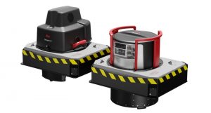
A lidar Sensors is a form of Light Detection and Ranging. It uses light in the form of a pulsed laser to measure the distance from the sensor to objects.
It measures the distance to a target by illuminating the target with pulsed laser light and then measuring the reflected light intensity.
Reflection of the light off of the target’s surface is detected using either a digital camera or photodetector. Lidar can measure the shape, distance, velocity, and other physical properties of objects in its path. Lidar works well when there’s nothing blocking its line of sight. It measures distances up to 250 meters away.
How Does Lidar Keep Us Safe
A self-driving vehicle cannot operate without lidar sensors. They are used for a variety of functions, including detecting objects and people, mapping the world in 3D, and providing navigation information.
Lidar sensors work by emitting short laser pulses from the car and then measuring the time it takes for the reflected light to return. The distance is calculated by measuring how much time it took for the light to travel between the car and any object in its path.
The time taken for this round trip varies depending on whether it was traveling through air or through one of many types of material: water, wood, metal, etcetera.
This is because different materials have different speeds of light propagation – that is, they have different permittivity (the measure of how easily a material can transmit an electric field).
What is the difference between Radar and LiDAR?
Radar and LiDAR are both remote sensing technologies that measure distance by sending out pulses of energy and timing how long it takes for them to bounce back.
They share a lot of similarities, but they also differ greatly.
Radar uses radio waves, which are a type of electromagnetic radiation, to measure distance. LiDAR, on the other hand, uses pulses of light, which is a different type of electromagnetic radiation. Because of this, LiDAR can provide a more detailed picture than Radar.
Another difference is that Radar can be used in all weather conditions, while LiDAR does not work as well in rainy or cloudy conditions.
Finally, Radar is typically used to measure larger objects, while LiDAR is better at imaging objects that are close up or moving very fast.
LiDAR Sensors system and data use:
The use of LiDAR is varied. Whether it is a video game developer, simulations based on 3D models are often used to prepare them for competition.
- LiDAR systems are often used for surveying tasks to collect three-dimensional measurements. In addition to creating digital terrain models (DTM), they can also create digital elevation models (DEMs).
- For surveying the built environment, laser scanning systems are also used. A building, a road network, and a railway are included in this category.
- To create accurate floorplans and measure space indoors, laser scanners are useful.
- LiDAR surveys are increasingly being used in the construction industry. Building projects are tracked using LiDAR technology and digital twins are created for BIM applications.
- LiDAR has a wide range of environmental applications. The use of lasers in mapping flood risk, carbon stocks in forests, and coastal erosion monitoring are popular.
- LiDAR has also become increasingly popular in automotive automation. Autonomous vehicles can benefit from smaller, low-range LiDAR scanners.
- Even in space, LiDAR data can be used! NASA considers it crucial to ensure the safe landing of lunar vehicles.
Conclusion
In conclusion, Lidar sensors (light detection and ranging) are becoming a more common part of autonomous vehicle development. They are used to create a 3-D picture of the environment around the vehicle and detect objects within range. There are uses outside of autonomous vehicles, however — ATMs, self-driving cars, and warehouse inventory systems all use the laser to scan and record objects.