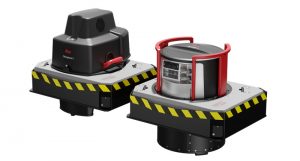
What is Terrestrial Laser Scanning?
Terrestrial laser scanning is a method of measuring buildings and other things with a tripod-based LIDAR (light detection and ranging) sensor.
What is Terrestrial Laser Scanning Used for?
Terrestrial laser scanning has a wide range of uses, such as capturing a wall’s flatness, preserving the conditions of a crime or accident scene, documenting the facade of a large building for pre-fab architectural panels, examining a vessel’s shape, volumetric stockpile inspections, and many others.
How does Terrestrial Laser Scanning Work?
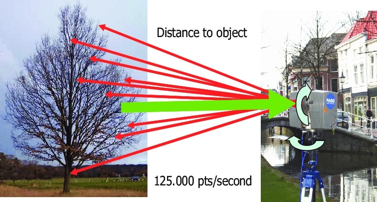
Terrestrial Laser Scanners measure 3D points using an invisible laser, much like a survey total station. The ability of the scanner to measure its full scene and the speed at which measurements are obtained make a difference.
360 degrees horizontally and 310 degrees vertically make up the laser’s field of view. To capture the entire scene, the tripod-mounted laser scanner will rotate as the mirror is also spun. Depending on the resolution, each scan takes between three and seven minutes.
What Measurements are Made with Terrestrial Laser Scanning?
Terrestrial laser scanners take measurements of anything in the laser’s line of sight. The scans capture even the tiniest details, such as the texture of brick, the foliage on trees, and the metalwork of elaborate handrails.
What is the Terrestrial Laser Scanner’s Accuracy? Does it perform better than a Pro-3D Camera?
Without a doubt, the terrestrial laser scanner is better compared to the pro-3D camera. At 30 feet, terrestrial laser scanners can measure points with an accuracy of 3 mm. A typical pro-3D camera cannot attain an accuracy of less than an inch. The “point clouds” produced by the scanner are made up of incredibly high-resolution points that are incredibly closely spaced apart; the end result resembles an image.
The scanner will revolve more slowly at higher resolutions, producing a more detailed point cloud. The point cloud becomes lighter as the scanner rotates faster because the laser has less time to record minute changes.
The resolution of the “project point cloud” is not always directly impacted by the resolution of the scanner. The number of points that collect from multiple low-resolution scans, for instance, will cause the resultant point cloud to have a better resolution when scanning a single wall.
Black and White or Color?
Laser scanning can be done in complete darkness, depending on the project’s needs or circumstances. This enables measurement and observation of objects in completely dark environments. Point cloud imaging that results from scanning in low light circumstances almost has the appearance of night vision since the scanner cannot detect color without the addition of artificial light. The 3D imagery will make everything that was previously very dark clearly visible.
What are Terrestrial Laser Scanning’s Benefits?
Benefits in Construction
Laser scanning in construction can provide quick and affordable documentation of the full construction process. A seamless capture and monitoring procedure is necessary for accurate dimensional inspection of complex components, such as free-form shape elements, documenting of deformation processes, monitoring of countermeasures, and project coordination to allow increased multi-trade project collaboration. By being able to look back and see the complete construction process from start to finish, taking scans at all stages of construction can help in the case of final building inspections.
Benefits in Architecture
Quickly, precisely, and with little to no disruption, capture the building’s “as-is” conditions. To develop previously unseen vistas, photorealistic imagery and 3D visualization of various architectural components are used. All mainstream CAD programs can use 3D data. FARO WebShare Cloud is an easy, safe, and universal web tool for exchanging scan data. In Autodesk Revit, the generated point clouds can be precisely modeled.