Marine LiDAR is a rapidly developing technology that provides detailed, high-resolution data from navigation and mapping applications in aquatic environments. LiDAR stands for Light Detection and Ranging and measures the distance between objects and the surrounding environment.
This technology has the potential to revolutionize the way we explore and survey the ocean floor. In this blog post, we will explore what Marine LiDAR is, how it works and how we can use it to explore and map the ocean floor. Marine LiDAR is quickly becoming an essential tool for oceanographers and researchers alike. We will explore the advantages of using LiDAR as a tool for oceanography and how this technology can help us better understand our oceans. Finally, we will look at the potential applications of Marine LiDAR for underwater exploration and mapping.
What is the Purpose of Marine LiDAR Underwater?
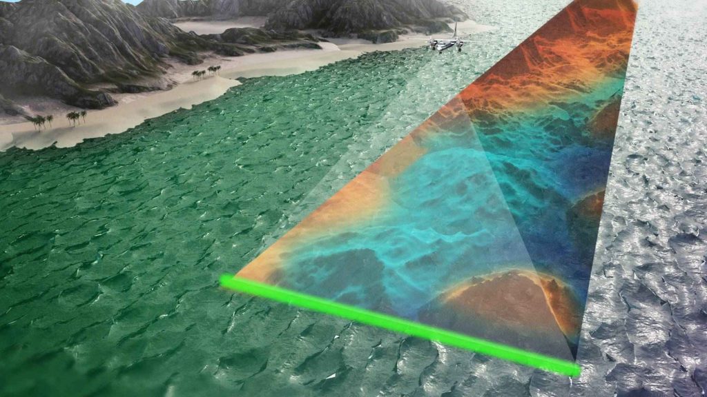
An airborne bathymetric Light Detection and Ranging (LiDAR) system is a remote sensing technology used to measure depth and elevation underwater. This system works by shooting pulses of laser light down toward the water’s surface and recording the time it takes for the light to return. By calculating the time difference, the system can determine the depth of the water. The light emitted by the system is so powerful that it can penetrate through the water column and reflect off the seabed. This data can then be used to generate maps of the seafloor. Besides measuring the shape and size of objects on the seabed, the system can also measure other parameters.
How does Bathymetric Lidar Work Underwater?
Bathymetric lidar is a remote-sensing technology used to measure the depths of bodies of water. It uses light waves to measure the elevation of the seafloor, lakebeds, and other underwater features. This data can be used to create detailed bathymetric maps and 3D models of the underwater environment, which can be used for various applications, such as navigation, coastal zone management, and marine resource exploration. Bathymetric lidar can also be used to measure wave heights and other water column features, as well as to detect objects such as wrecks, pipelines, and cables that may be submerged beneath the surface.
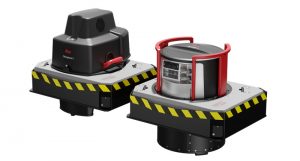
There are Four Main Components of Bathymetric LiDAR Sensors:
- The signal is emitted in a specific pattern by a laser scanner.
- Detector – This reads the signal returning from the sensor.
- GPS receivers determine an aircraft’s location.
- The inertial measurement unit (IMU) measures the aircraft’s roll.
In an airborne bathymetric LiDAR system, orientation and position are understood for accurate measurements. In some cases, it is possible to detect more than 1 million points per second with bathymetric LiDAR. There are more than 10 points per m2 in shallow water surveys.
LiDAR systems that measure at higher frequencies and ranges have more laser power per pulse. These systems have a range between 2.0 and 3.0 times the Secchi depth measurement.
Bathymetry survey operators tend to use twin optical port survey aircraft simultaneously with shallow-water and deep-water sensors to maximize detail and coverage.
Can LiDAR be Used in the Ocean?
Yes, LiDAR can provide accurate and reliable results over water. However, certain factors should be considered. The water surface causes refraction of the laser pulses, affecting the measurements’ accuracy. As a laser pulse travels deeper underwater, its energy decreases. Accuracy can be decreased as a result.
Does iPhone LiDAR Work Underwater?
iPhones work underwater, but other devices do not; LiDAR is unavailable underwater due to light not penetrating the water. LiDAR works by sending out light pulses and measuring their reflection to calculate distances and create a 3D environment model. This process simply cannot be done when the light is unable to penetrate through the water, as the reflections would be insufficient to detect.
Can Marine LiDAR Detect Water Depth?
Yes, Marine LiDAR can be used to detect water depth. A LiDAR system uses a laser to illuminate a target and analyze the reflected light. This technology can measure the depth of a body of water by aiming the laser at the surface of the water and measuring the time it takes for the laser to reflect back. By calculating the time the laser light travels to the bottom of the water and back, you can determine the depth of the water. LiDAR is especially useful for monitoring water depths in difficult areas such as rivers, lakes, and oceans.
In conclusion, Marine LiDAR and Bathymetric are essential for underwater surveying. Marine LiDAR is ideal for shallow water environments, while Bathymetric can accurately survey deeper waters. It is possible to use them to measure the depth of the water, detect underwater objects, and create detailed topographic maps. Marine LiDAR and Bathymetric can provide a comprehensive view of the underwater environment and help us better understand the ocean floor.