Lidar mapping UK is a technology that has revolutionized how we collect terrain data. It uses laser sensors to create high-resolution images of the Earth’s surface, allowing for accurate elevation measurements and other features. In the UK, lidar mapping has become increasingly popular due to its ability to provide precise and detailed terrain data. This information is critical for various applications, including land management practices, urban planning, and environmental protection. In this article, we will explore the benefits of lidar mapping UK and how it is being used to optimize land management practices and protect sensitive habitats.
What is lidar mapping?
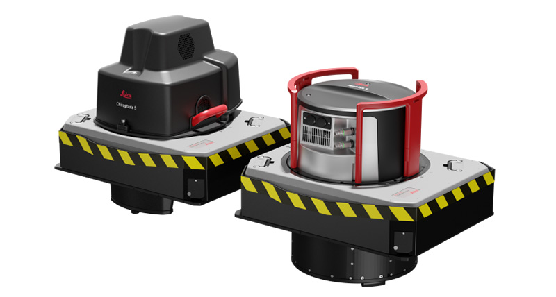
It stands for Light Detection and Ranging. This technology measures distances between objects or surfaces using laser beams. Lidar sensors can use laser pulses that bounce back to create highly accurate 3D maps of landscapes and environments.
History of lidar mapping UK
The use of lidar mapping UK dates back to the 1990s when the first lidar surveys were conducted for military applications. In the early 2000s, the UK government began investing in lidar mapping technology for environmental and civil engineering applications. Since then, lidar mapping has become an essential tool for a wide range of industries in the UK.
How lidar mapping UK works
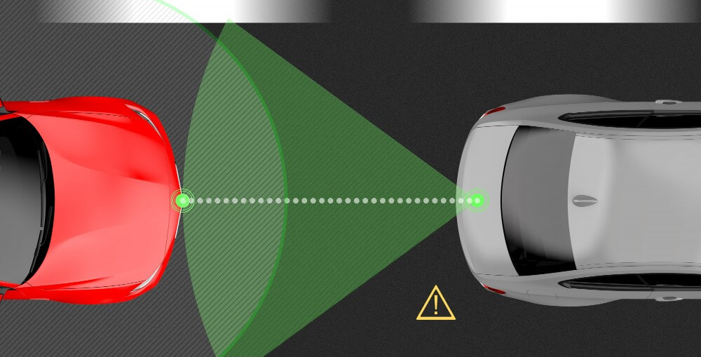
A laser mapping sensor emits laser pulses that bounce back after hitting an object or surface, allowing the time for the pulse to be measured. A lidar sensor can calculate the distance between an object or surface by calculating the return time of the pulses. Calculating the time it takes for pulses to return helps lidar sensors determine distance. This process is repeated thousands of times per second, creating a highly accurate 3D map of the environment.
Benefits of lidar mapping UK
One of the main benefits of lidar mapping is its ability to create highly accurate 3D maps of landscapes and environments. These make it an invaluable tool for various applications, including environmental monitoring, flood risk management, archaeology, urban planning, forestry management, and energy generation.
Applications of lidar mapping UK
Lidar mapping has become an essential tool for a wide range of industries in the UK.
Typical uses of lidar mapping UK include:
Lidar mapping and environmental monitoring
Lidar mapping is an essential tool for environmental monitoring in the UK. It can create highly accurate maps of landscapes and environments, allowing researchers to track changes over time. Monitoring changes in vegetation, water level, and land use is essential.
Lidar mapping and flood risk management
Lidar mapping is also essential for flood risk management in the UK. The use of Lidar mapping UK can help identify areas at high risk of flooding by creating highly accurate maps. This information can be used to develop flood management strategies and mitigate the impact of flooding on local communities.
Lidar mapping and archaeology
Lidar mapping is also an essential tool for archaeology in the UK. It enables archaeologists to uncover hidden archaeological features in landscapes and environments that are not visible to the naked eye. Lidar mapping UK has already led to some significant discoveries in the UK, including discovering lost Roman roads and uncovering a previously unknown Iron Age hillfort in Wales.
Lidar mapping and urban planning
Lidar mapping is also an essential tool for urban planning in the UK. Using lidar mapping, we can identify areas at risk of flooding, landslides, and other natural disasters. It can also map and analyze urban infrastructure, such as roads, buildings, and public spaces.
Lidar mapping and forestry management
Lidar mapping is also an essential tool for forestry management in the UK. It can be used to create highly accurate maps of forests, allowing foresters to monitor tree growth, assess the health of the forest, and identify areas that may be at risk of forest fires or other natural disasters. Lidar mapping can also map forest trails, roads, and other infrastructure.
Lidar mapping and energy generation
Lidar mapping is also an essential tool for energy generation in the UK. It can be used to create highly accurate maps of wind and solar resources, allowing energy companies to identify the best locations for wind turbines and solar panels. Lidar mapping can also map transmission lines, substations, and other energy infrastructure.
Future of lidar mapping UK
The future of lidar mapping in the UK looks bright. Technology is becoming more affordable and accessible, allowing more organizations to take advantage of its benefits. As lidar sensors become smaller and more powerful, they can capture more detailed information about the environment, leading to even more applications for lidar mapping.
Challenges facing lidar mapping UK
Despite its many benefits, lidar mapping also faces some challenges in the UK. One of the main challenges is the cost of the technology, which can be prohibitively expensive for some organizations. Another challenge is the need for skilled professionals who can interpret the lidar data and use it to make informed decisions.
Conclusion
Lidar mapping has revolutionized how we map and understand the world around us. In the UK, lidar mapping has become essential for environmental monitoring, flood risk management, archaeology, urban planning, forestry management, and energy generation. While lidar mapping still faces some challenges, its many benefits make it a technology that plays a vital role in the UK and beyond.
FAQs:
How accurate is lidar mapping?
Lidar mapping is highly accurate, with the ability to measure distances within a few centimeters.
What equipment is needed for lidar mapping?
Lidar mapping requires a lidar sensor, a GPS receiver, and a computer to process the data.
How is lidar mapping different from other mapping technologies?
Lidar mapping differs from other mapping technologies, such as satellite imagery or traditional surveying, because it uses laser beams to create highly accurate 3D maps of landscapes and environments.
How is lidar mapping used in the UK?
Lidar mapping is used in the UK for various applications, including environmental monitoring, flood risk management, archaeology, urban planning, forestry management, and energy generation.
How can lidar mapping benefit the environment?
It provides accurate data on vegetation, water levels, and land use, which can be used to optimize land management practices and protect sensitive habitats.
