A LiDAR is an innovative form of remote sensing that has been sweeping the surveying industry by storm. LiDAR surveys can capture 3D data quickly and easily. In recent years, laser pulses have become increasingly popular for calculating distances, capturing precise measurements, and measuring ranges. It is an accurate, quick, and flexible way of collecting data.
There are a number of industries that can benefit from LIDAR, including civil engineering, roadwork, and mining.
Basic about LiDAR
LiDAR technology was developed in the 1960s when planes were equipped with laser scanners. The airborne LiDAR measured distances by emitting light beams toward the ground. LiDAR data became a useful tool for calculating geospatial data in the late 1980s. In order to accomplish this, commercially viable GPS systems were introduced.
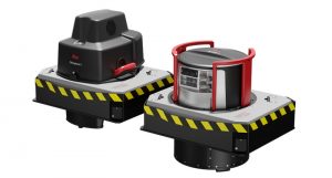
LiDAR Surveying
The position of a LIDAR-equipped drone will also be determined by its GPS system during aerial survey operations. Depending on what you plan to do with the data, you may also need a decent computer to process all the data.
There is no need to use ground control points with LIDAR – although a couple can help you validate your accuracy. You will be able to conduct operations much more quickly. In addition to being less time-consuming as you won’t need to process many high-res RGB files.
What are the benefits of LIDAR surveying?
LIDAR can be extremely beneficial in many aspects of aerial surveying and drone inspection operations. A simple RGB payload may be sufficient for some very effective results in many areas, as discussed. LIDAR systems can be optimized to explore areas that a visual camera cannot or to work purely with data associated with a survey rather than photos.
Read This: Lidar Sensors: How Does Lidar Keep Us Safe
Which industries are being impacted by LIDAR surveying?
Engineering applications cover all aspects of infrastructure and maintenance. As well as road networks, LIDAR is used to map and monitor traffic flow, as well as road signs and surrounding locations.
Also used after road accidents at night for detailed evidence collection in darkness, allowing the road to be reopened before the morning rush.
LIDAR is also used to verify safety after explosives have been used in mines. It can even be used to avoid collisions since it’s capable of determining how far away it is from walls in complete darkness, even after tunnels have just opened up.
In conclusion
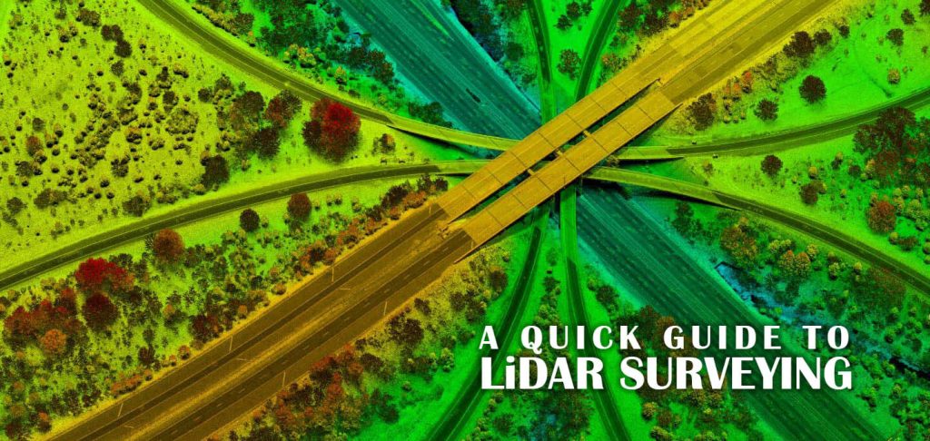
LIDAR surveying is one of the more advanced types of surveying done by professional engineers. It involves the use of laser devices that shoot lasers from a point in space and collect reflected signals. These signals can be analyzed by professional survey engineers to determine the distance, angle, and elevation of target points.
Read This: 3D Sensing Technology – New Ways of Sensing the World
FAQ
What is LiDAR surveying?
LiDAR surveying is a remote sensing technology that uses laser pulses to measure distance. LiDAR can be used to create highly accurate 3D models of the earth’s surface. This technology is often used for engineering, environmental, and archaeological applications.
How accurate is the LiDAR survey?
The LiDAR survey is a powerful tool that can provide accurate data for a variety of applications. However, like all surveying tools, there are certain limitations that must be considered when using LiDAR data. In order to ensure the accuracy of the data, it is important to understand these limitations and to use the data accordingly.
What is LiDAR drone surveying?
LiDAR drone surveying is an emerging technology that is revolutionizing the surveying industry. LiDAR stands for Light Detection and Ranging and is a remote sensing technology that uses lasers to measure distance. LiDAR drone surveying is a process of using a drone equipped with a LiDAR sensor to collect data about the ground surface. This data can then be used to create accurate 3D models of the area that was surveyed.
Why is LiDAR the future of surveying?
LiDAR is set to revolutionize the surveying industry due to its ability to collect highly accurate data quickly and efficiently. This technology uses laser pulses to map out an area, and is therefore ideal for surveying large tracts of land or areas with complex terrain. In addition, LiDAR data can be used to create 3D models which can be extremely helpful for planning and development purposes. As surveying technology continues to evolve, LiDAR is poised to become the new standard due to its many advantages. Those in the surveying industry should keep an eye on this developing technology in order to stay ahead of the curve.