3D LiDAR Sensors and Laser sensor technology
  • Products
  • Who We Are
  • Our News
  • Jobs
  • Contact Us
  • Blog
Menu
  • Products
  • Who We Are
  • Our News
  • Jobs
  • Contact Us
  • Blog
Request a Quote
3D laser scanning survey

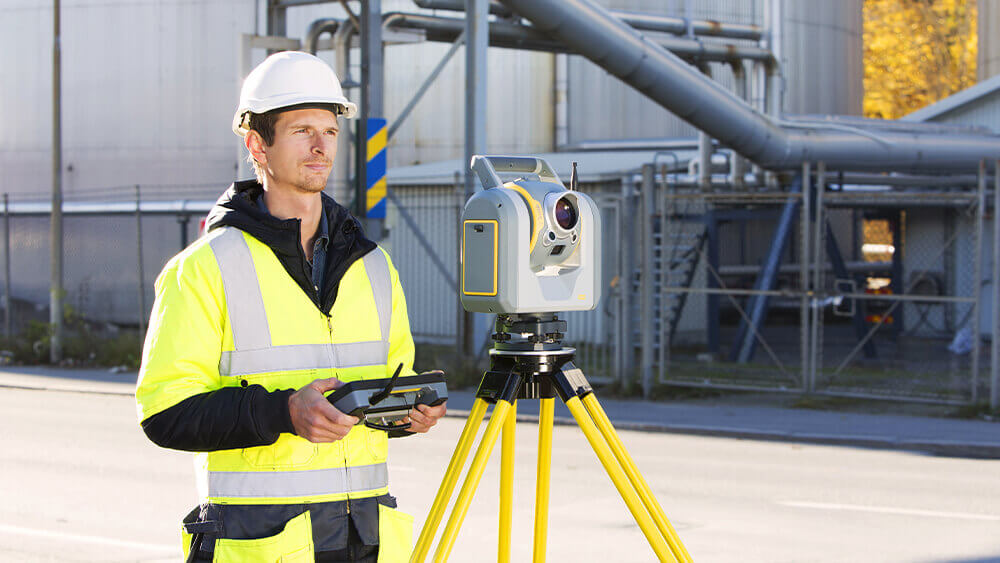
How 3D Laser Scanning survey is Revolutionizing the Surveying Industry

November 5, 2022

You’ve come to the right place if you need to know the ins and outs of 3D laser scanning surveys. This type of survey uses

Read More »

3D Lidar Sensors Technology: What Are The Uses?

October 31, 2022

A remote sensing device known as Lidar, or “Light Detection and Ranging,” measures distances to the Earth using light as a beat laser. These light

Read More »
A QUICK GUIDE TO LiDAR SURVEYING

A QUICK GUIDE TO LiDAR SURVEYING | LiDAR Surveys

October 20, 2022

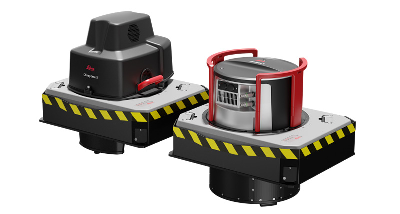
A LiDAR is an innovative form of remote sensing that has been sweeping the surveying industry by storm. LiDAR surveys can capture 3D data quickly

Read More »
3d lidar technology

Discovering the basics of 3D LiDAR technology

October 17, 2022

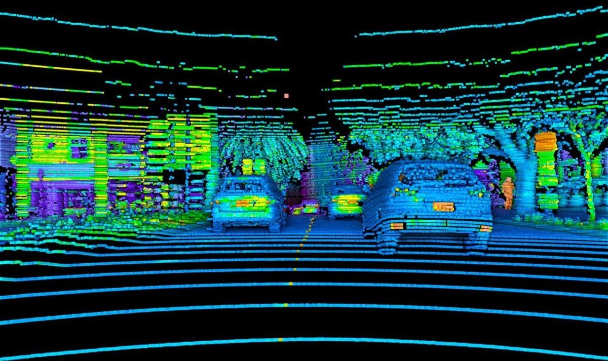
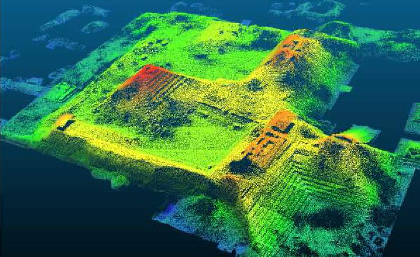
3D lidar technology is a remote sensing technology for measuring distances in an environment using light detection and ranging, also known as LiDAR. It plays

Read More »
Lidar sensors

Lidar Sensors: How Does Lidar Keep Us Safe

October 14, 2022

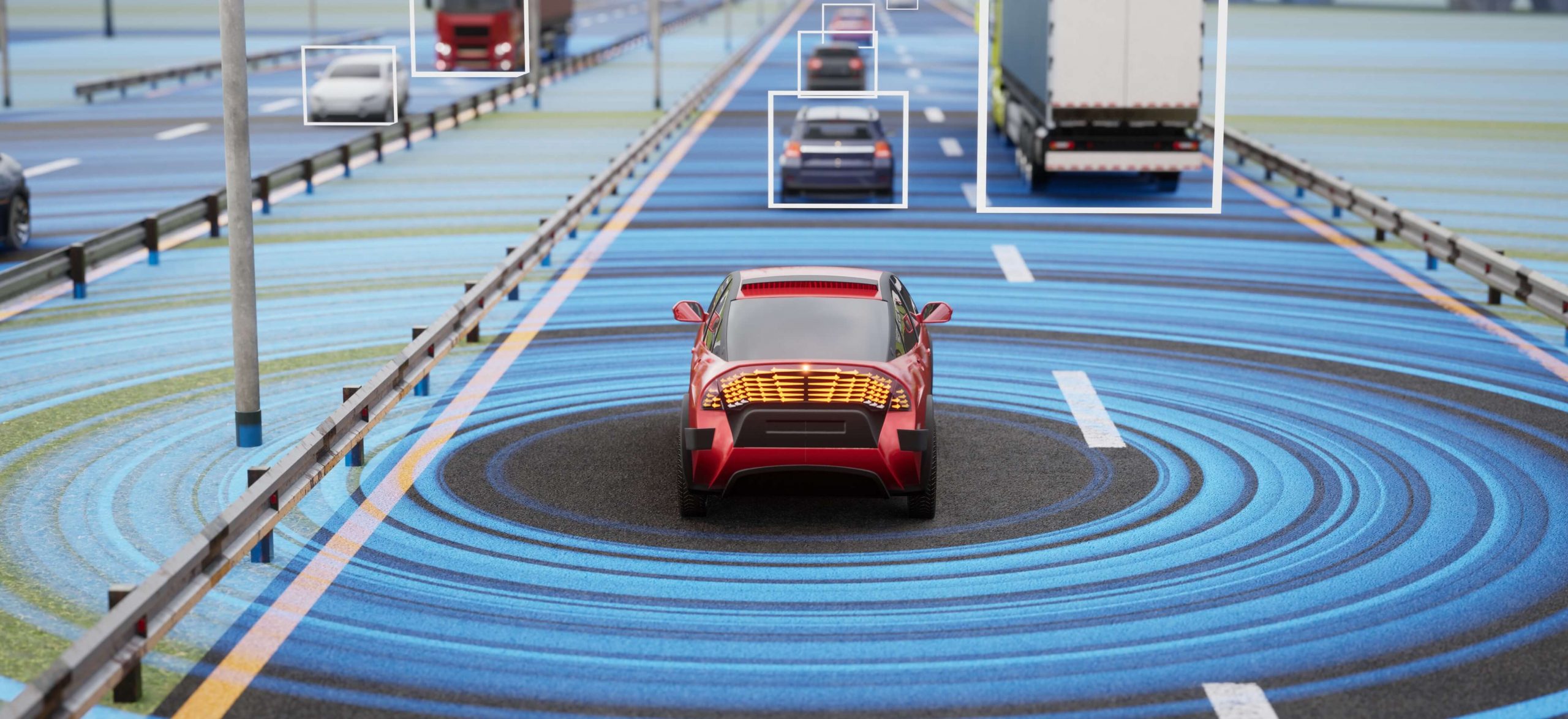
Lidar sensors are a type of sensor that uses lasers to measure distance. They are often used in autonomous vehicles to help the vehicle navigate

Read More »
Car Proximity Sensor

What is A Car Proximity Sensor And How Do They Work?

September 29, 2022

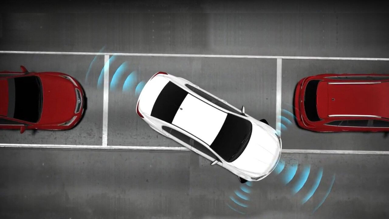
Even seasoned drivers acknowledge that parallel parking and confined parking spaces are challenging. Cars are frequently slid into strange parking spaces by motorists. To do

Read More »

3D Laser Scanning Services For Architecture And Construction

September 23, 2022

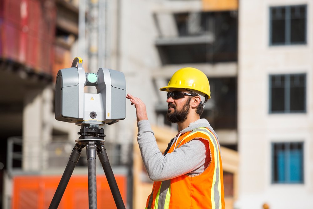
A novel and practical approach to take a picture of an object in a way that wasn’t previously conceivable is through 3D laser scanning services.

Read More »

LiDAR Technology and 5 Applications of LiDAR Technology

September 20, 2022

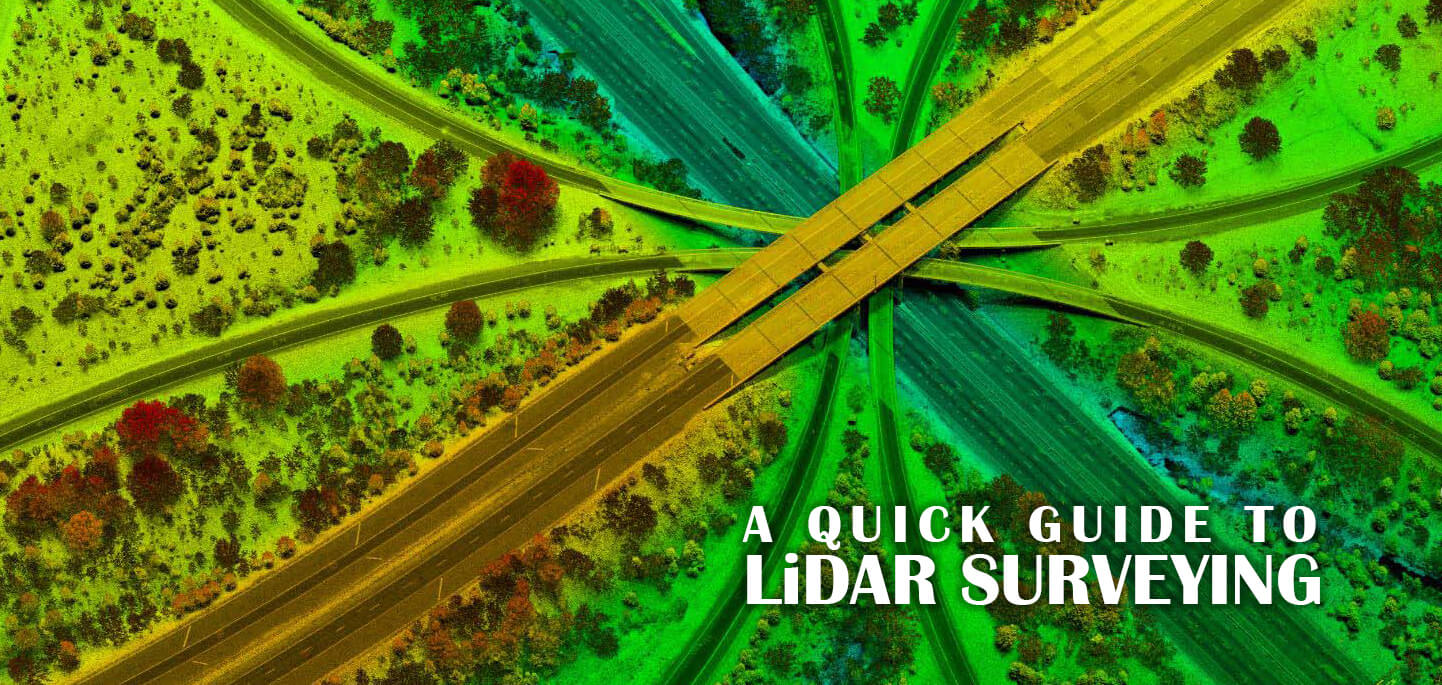
Using LiDAR technology, we can scan and map any environment by projecting laser beams and time-tracking their return. One of the most well-known uses of

Read More »

Scaniverse – free LiDAR scanning app on your iPhone 2022

September 13, 2022

Scaniverse: what is it? By laser-targeting an object and timing how long it takes for the reflected light to return to the receiver, a LiDAR

Read More »

3D Sensing Technology – New Ways of Sensing the World

September 8, 2022

3D sensing technology is an exciting new development that has the potential to revolutionize the way we interact with the world around us. This technology

Read More »
Page1 Page2 Page3 Page4 Page5 Page6

Recent posts from our blog

UK lidar map

UK lidar map | How to use lidar map in UK?

Mobile Mapping Sensor

Experience Mapping Redefined: Coral Mobile 3D Mobile Mapping Sensor.

Lidar Vision for Robots

Lidar Vision for Robots: How It Can Enhance Your Robot’s Ability to See

bathymetric lidar sensor

What Light Does Bathymetric Lidar Sensor Use and Why?

PRECISION-LASER-Automation

Spectra Precision Laser: The Ultimate Tool for Perfection in Your Next Project

lidar mapping uk

Understanding Lidar Mapping UK for Accurate Terrain Data 2023

LiDAR DEM Correction in Channel Profiles

LiDAR DEM Correction in Channel Profiles

Lidar Pipe Inspection: Advanced Technology for Accurate Data Collection 2023

Revolutionizing Business Operations: The Combined Benefits of LiDAR and SEPA

© 2022 RedSensors.Com. All Right Reserved | Privacy Policy